Pearl Harbor Attack
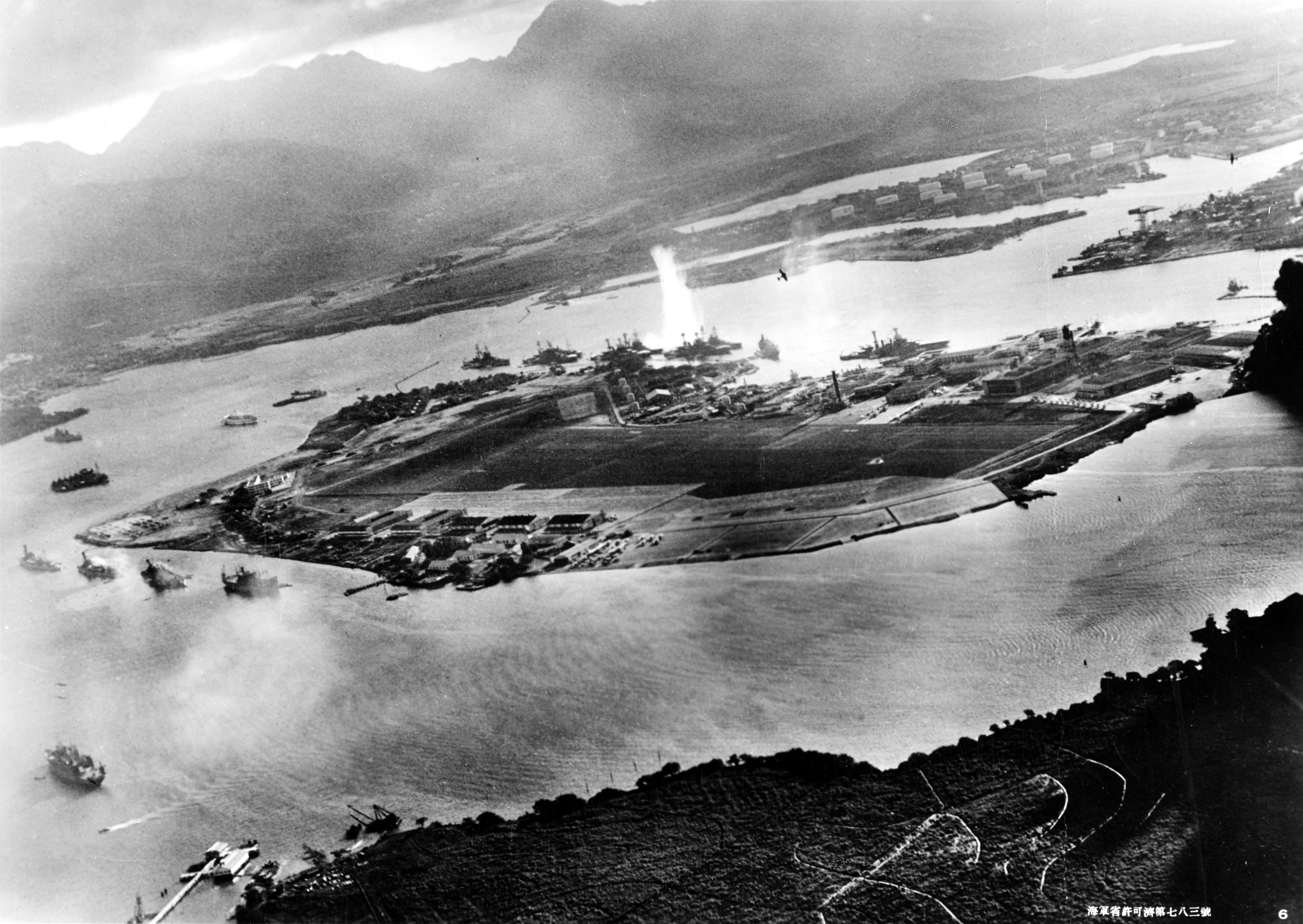
This is Pearl Harbor, on the island of Oahu in Hawaii — a volcanic archipelago sitting roughly 2,400 miles from the North American mainland, isolated in the central Pacific Ocean. In December 1941, aircraft launched from carriers attacked the United States Pacific Fleet at anchor there, using dive bombers and torpedo planes; the raid killed over 2,400 Americans and destroyed or damaged dozens of warships and aircraft while the United States was still neutral in World War II.
Hawaii is the most geographically isolated island chain on Earth, sitting atop a volcanic hotspot where the Pacific Plate slowly drifts northwest, creating a long chain of progressively older islands stretching toward the Aleutians. Its mid-ocean position made it the United States' critical western anchor in the Pacific, thousands of miles from any continent.
This event appears in EraPin — a daily game where you decode geographic clues to place historical events on the map. Five rounds. Free to play.
Play today's EraPin →For teachers
This event in EraPin gives students practice in absolute and relative location reasoning — a core skill in the C3 Framework and most geography standards.
The clue uses spatial language students must decode:
Combined with the era markers (Carrier-launched torpedo planes, battleships at anchor, and radar still unproven in wartime.), students reason their way to Pearl Harbor, United States in 1941 without prior knowledge of the specific event. Each clue is designed to teach geographic literacy, not just test it.
See how EraPin works in classrooms →Related events
Source: EraPin event archive. Historical details drawn from publicly available sources including Wikipedia.