1933
Nazi Rise to Power (Hitler Appointed Chancellor)
BERLIN · GERMANY
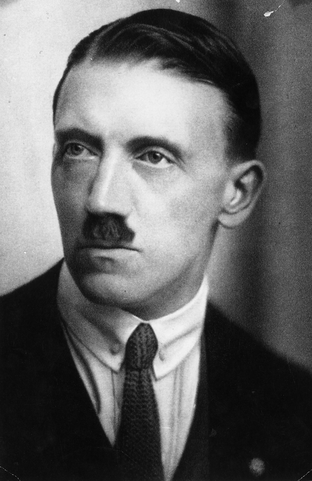
This event unfolded in Berlin, the capital of Germany — a city planted firmly on the flat North European Plain, roughly halfway between the Rhine River to the west and the Oder River marking the eastern frontier. On January 30, 1933, Adolf Hitler was appointed Chancellor of…
Read the full account
This event unfolded in Berlin, the capital of Germany — a city planted firmly on the flat North European Plain, roughly halfway between the Rhine River to the west and the Oder River marking the eastern frontier. On January 30, 1933, Adolf Hitler was appointed Chancellor of Germany, handing the Nazi Party the foothold it needed to rapidly dismantle democratic institutions and impose totalitarian rule — a transformation that became a primary driver of World War II. Berlin sits deep in the heart of the North European Plain, a vast low-lying corridor of flat land stretching from France all the way to Russia, with no major mountain barriers to slow the movement of armies or ideas — which is part of why this region has been a crossroads of European power for centuries. That same open geography made Germany both a cultural and military pivot point of the continent.
1938
Munich Agreement
MUNICH · GERMANY

Munich, Germany — a major city on the Bavarian plateau, tucked between the Main River to the north and the Alps rising sharply to the south — was where this fateful agreement was signed in 1938. Representatives from Britain, France, Italy, and Germany met there to decide the…
Read the full account
Munich, Germany — a major city on the Bavarian plateau, tucked between the Main River to the north and the Alps rising sharply to the south — was where this fateful agreement was signed in 1938. Representatives from Britain, France, Italy, and Germany met there to decide the fate of Czechoslovakia, a neighbouring central European nation that was given no seat at the table; the deal handed over Czechoslovakia's heavily fortified Sudetenland border region to German military occupation. Munich sits in Bavaria, Germany's largest state, positioned at the northern foot of the Alps where the Isar River flows down from the mountains onto the broad south German plain — a geographic crossroads between the Alpine world and the North European lowlands. That central position made it a natural meeting point for European powers, but the agreement reached there is remembered as a defining lesson in how geography and diplomacy can leave smaller nations dangerously exposed.
1938
German Annexation of Austria (Anschluss)
VIENNA · AUSTRIA

Vienna, the capital of Austria, sits in the Danube basin at the eastern edge of the Alps — exactly the landlocked alpine crossroads at the heart of central Europe that the title described. In March 1938, Nazi Germany absorbed Austria into the Third Reich in a takeover known as…
Read the full account
Vienna, the capital of Austria, sits in the Danube basin at the eastern edge of the Alps — exactly the landlocked alpine crossroads at the heart of central Europe that the title described. In March 1938, Nazi Germany absorbed Austria into the Third Reich in a takeover known as the Anschluss, with German forces crossing the border and meeting no military resistance as the country was folded into the expanding German state. Austria occupies a crucial geographic hinge in Europe: the Alps form its spine and western wall, while the Danube River cuts through the country eastward, linking it to the Balkans and the Black Sea — a corridor that has made this region a crossroads of trade, migration, and conquest for thousands of years. Vienna itself grew powerful partly because whoever controlled this Danube gateway controlled movement between western and eastern Europe.
1938
Kristallnacht (Night of Broken Glass)
BERLIN · GERMANY

Berlin, Germany — a capital city sitting in the broad North European Plain, flanked by the Rhine and Elbe rivers to the west and the Baltic coast to the north — was the epicenter of the coordinated pogroms of Kristallnacht on the nights of November 9–10, 1938. Nazi-organized…
Read the full account
Berlin, Germany — a capital city sitting in the broad North European Plain, flanked by the Rhine and Elbe rivers to the west and the Baltic coast to the north — was the epicenter of the coordinated pogroms of Kristallnacht on the nights of November 9–10, 1938. Nazi-organized mobs across Germany and Austria destroyed thousands of Jewish-owned businesses, homes, and synagogues, killing nearly 100 Jewish people and sending over 30,000 to concentration camps. Germany occupies the heart of Central Europe, a flat, open plain that historically made it both a crossroads of trade and a corridor for armies moving between Eastern and Western Europe. That central position meant the terror of these nights spread rapidly across a wide geographic area, from the Rhine in the west deep into Austria to the southeast, covering much of the continent's midsection.
1939
German Invasion of Poland
WARSAW · POLAND
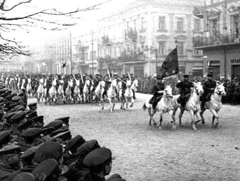
This is Warsaw, the capital of Poland — a city sitting on the Vistula River, on the broad North European Plain that stretches from the Baltic coast south to the Carpathian Mountains. On September 1, 1939, Nazi Germany launched a massive military invasion of Poland from multiple…
Read the full account
This is Warsaw, the capital of Poland — a city sitting on the Vistula River, on the broad North European Plain that stretches from the Baltic coast south to the Carpathian Mountains. On September 1, 1939, Nazi Germany launched a massive military invasion of Poland from multiple directions, overwhelming Polish defenses; Britain and France responded by declaring war on Germany, formally beginning World War II in Europe. Poland occupies a critical geographic position: it is the wide, flat corridor between Germany to the west and Russia to the east, with no major mountain barriers to slow an army moving east or west across the plain. This openness has made Poland one of history's most invaded territories — the same flat terrain that made it a crossroads for trade also made it a highway for armies across centuries.
1940
Dunkirk Evacuation (Operation Dynamo)
DUNKIRK · FRANCE

This is Dunkirk, in northern France — sitting on the southern shore of the English Channel at its narrowest point, directly across from the English coast and tucked between the Rhine delta to the northeast and the Strait of Dover to the west. From May 26 to June 4, 1940, during…
Read the full account
This is Dunkirk, in northern France — sitting on the southern shore of the English Channel at its narrowest point, directly across from the English coast and tucked between the Rhine delta to the northeast and the Strait of Dover to the west. From May 26 to June 4, 1940, during Operation Dynamo, roughly 338,000 British and Allied soldiers were evacuated from Dunkirk's beaches by a fleet of naval vessels and civilian boats as German forces closed in — one of the largest military rescues in history. Dunkirk lies on the North Sea coast of France, a low, flat shoreline shaped by centuries of tidal action and reclaimed land, making it geographically exposed with almost no natural defensive barriers. That same flat, open coastline that made the army so vulnerable also made it accessible to hundreds of small civilian boats, which is precisely why the rescue was possible at all.
1940
Battle of Britain
LONDON · UNITED KINGDOM
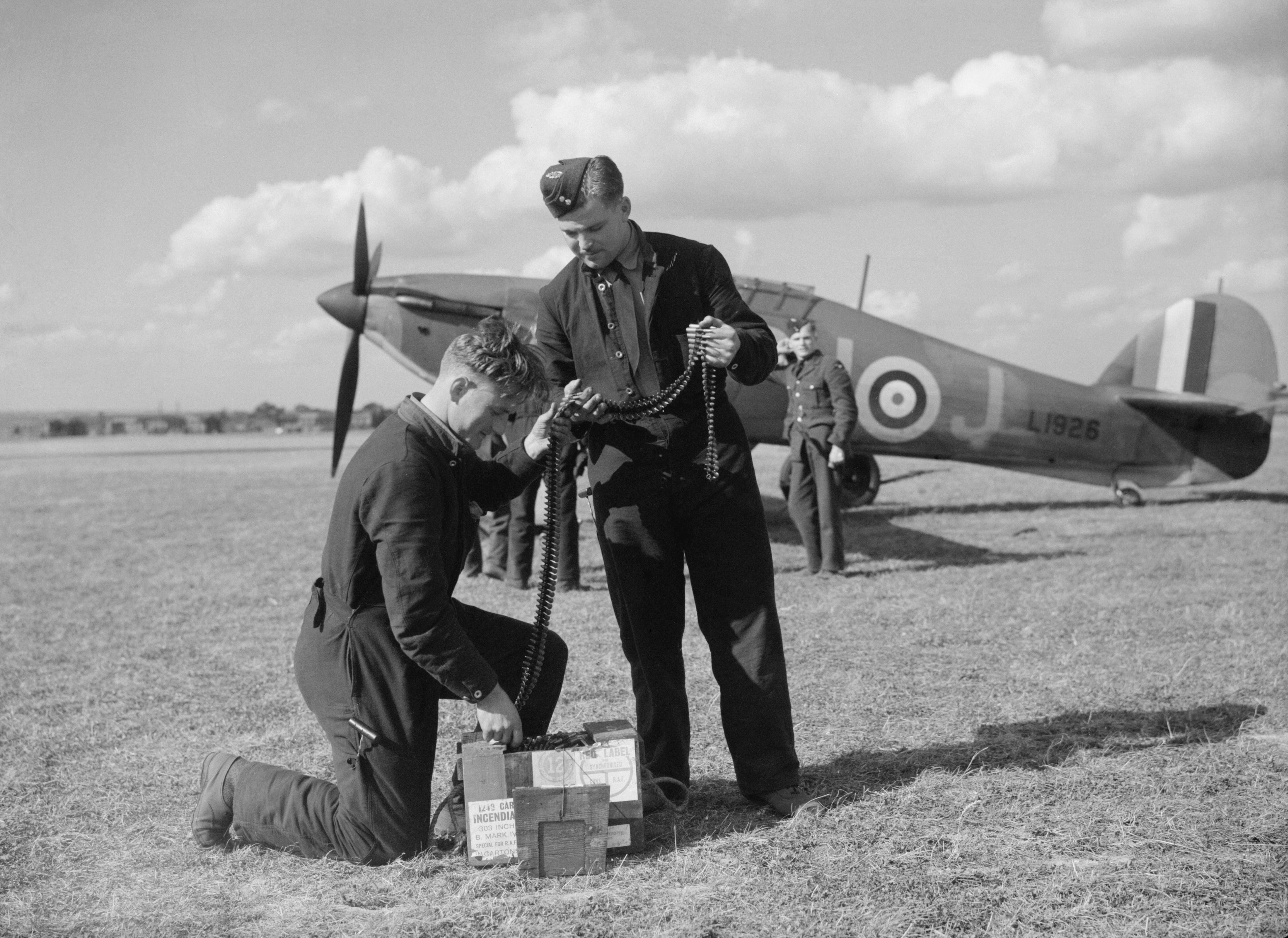
This is London, the capital of the United Kingdom — sitting on the River Thames in southeast England, on the island of Great Britain, separated from continental Europe by the narrow English Channel. From July to October 1940, Nazi Germany's Luftwaffe launched a sustained bombing…
Read the full account
This is London, the capital of the United Kingdom — sitting on the River Thames in southeast England, on the island of Great Britain, separated from continental Europe by the narrow English Channel. From July to October 1940, Nazi Germany's Luftwaffe launched a sustained bombing campaign against Britain, including the Blitz, targeting London and other cities in an attempt to destroy British air power and force surrender. Britain held on, aided by radar technology and its fighter pilots, marking one of the most consequential defensive stands of the Second World War. Great Britain is the largest island in Europe, positioned where the Atlantic Ocean meets the North Sea, and that stretch of water — the English Channel, barely 33 kilometres wide at its narrowest — has acted as a natural moat protecting the island from invasion throughout its history.
1940
Blitzkrieg and Fall of France
PARIS · FRANCE

Paris, France — the capital sitting in the Seine river basin of Western Europe, just inland from the coast facing England across the narrow English Channel — was the prize at the center of this campaign. In May–June 1940, Germany launched a rapid Blitzkrieg assault that…
Read the full account
Paris, France — the capital sitting in the Seine river basin of Western Europe, just inland from the coast facing England across the narrow English Channel — was the prize at the center of this campaign. In May–June 1940, Germany launched a rapid Blitzkrieg assault that overwhelmed Allied defenses in just six weeks, forcing France's surrender and leaving Britain as the only major Allied power still fighting in Western Europe. France occupies the southwestern corner of the European mainland, bordered by the English Channel to the north, the Atlantic to the west, the Pyrenees mountains to the south, and the Rhine river to the east — a geographic crossroads that has made it a recurring battleground throughout history. That central position between northern Europe's plains and the Atlantic coast means armies moving west from Germany face relatively flat, open terrain — exactly the kind of ground that fast-moving armored tactics were designed to exploit.
1941
Atlantic Charter
PLACENTIA BAY, NEWFOUNDLAND · CANADA
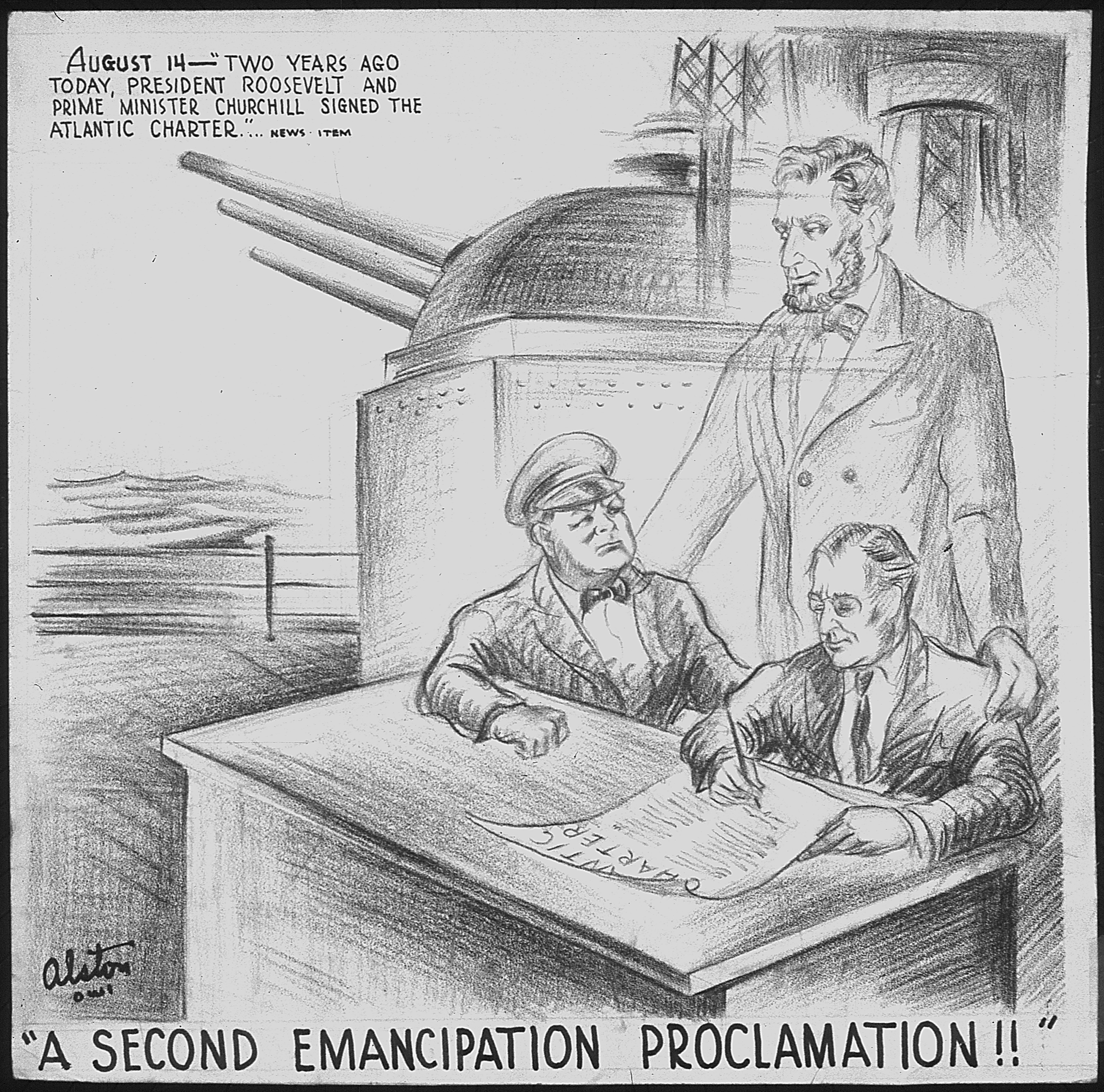
This meeting took place in Placentia Bay, off the coast of Newfoundland, Canada — the large island sitting at the northeastern edge of North America where the Gulf of St. Lawrence opens into the Atlantic Ocean. In August 1941, U.S. President Franklin D. Roosevelt and British…
Read the full account
This meeting took place in Placentia Bay, off the coast of Newfoundland, Canada — the large island sitting at the northeastern edge of North America where the Gulf of St. Lawrence opens into the Atlantic Ocean. In August 1941, U.S. President Franklin D. Roosevelt and British Prime Minister Winston Churchill met aboard a ship here and jointly issued the Atlantic Charter, a declaration outlining Allied goals for the post-war world, including the rights of peoples to self-determination and the pursuit of collective security. Newfoundland occupies a strategically vital position: it juts into the North Atlantic at the closest point between North America and Europe, making it a natural crossroads for transatlantic shipping lanes and military operations. During the Second World War, this geography made Newfoundland a critical base for convoy routes supplying Britain across the ocean.
1941
Attack on Pearl Harbor
PEARL HARBOR · UNITED STATES

This is Pearl Harbor, on the island of Oahu in Hawaii — a volcanic archipelago sitting roughly 2,400 miles from the North American mainland, isolated in the central Pacific Ocean. In December 1941, aircraft launched from carriers attacked the United States Pacific Fleet at…
Read the full account
This is Pearl Harbor, on the island of Oahu in Hawaii — a volcanic archipelago sitting roughly 2,400 miles from the North American mainland, isolated in the central Pacific Ocean. In December 1941, aircraft launched from carriers attacked the United States Pacific Fleet at anchor there, using dive bombers and torpedo planes; the raid killed over 2,400 Americans and destroyed or damaged dozens of warships and aircraft while the United States was still neutral in World War II. Hawaii is the most geographically isolated island chain on Earth, sitting atop a volcanic hotspot where the Pacific Plate slowly drifts northwest, creating a long chain of progressively older islands stretching toward the Aleutians. Its mid-ocean position made it the United States' critical western anchor in the Pacific, thousands of miles from any continent.
1941
The Holocaust
AUSCHWITZ · POLAND

Auschwitz, in southern Poland — a country on the northern edge of the Carpathian Mountains, at the heart of Europe's great northern plain — was the largest and most lethal site in a continent-wide system of persecution. Between 1941 and 1945, the Nazi regime and its…
Read the full account
Auschwitz, in southern Poland — a country on the northern edge of the Carpathian Mountains, at the heart of Europe's great northern plain — was the largest and most lethal site in a continent-wide system of persecution. Between 1941 and 1945, the Nazi regime and its collaborators systematically murdered approximately six million Jewish people across occupied Europe, with Auschwitz alone accounting for an estimated 1.1 million deaths. Poland sits at a geographic crossroads where the flat northern European plain stretches unbroken from France to Russia, making it historically one of the most invaded and contested territories on the continent. That same open, borderless terrain — with no mountain ranges or seas to slow movement — meant occupying forces could extend their reach rapidly across the region.
1942
Second Battle of El Alamein
EL ALAMEIN · EGYPT

El Alamein, Egypt — a small railway halt on the narrow coastal plain between the Mediterranean Sea and the Sahara Desert, roughly midway along Africa's northern coastline. In late 1942, Allied forces defeated the Axis army here in a pivotal Second World War engagement, halting…
Read the full account
El Alamein, Egypt — a small railway halt on the narrow coastal plain between the Mediterranean Sea and the Sahara Desert, roughly midway along Africa's northern coastline. In late 1942, Allied forces defeated the Axis army here in a pivotal Second World War engagement, halting the German and Italian advance and protecting the Suez Canal, the critical waterway linking the Mediterranean to the Red Sea. Egypt's north coast sits at the crossroads of Africa, Europe, and Asia — whoever controlled this strip controlled access to the Suez Canal, which connects Europe's shipping lanes to the Indian Ocean and beyond. El Alamein itself is less than 100 kilometres west of the Nile Delta, meaning the battle was fought at the very edge of Egypt's most populated and agriculturally vital region.
1942
Bataan Death March
BATAAN · PHILIPPINES

Bataan, Philippines — a narrow peninsula jutting southward exactly as the clue described, squeezed between Manila Bay to the east and the South China Sea to the west, near the northern end of the Philippine archipelago. In April 1942, after three months of brutal fighting, the…
Read the full account
Bataan, Philippines — a narrow peninsula jutting southward exactly as the clue described, squeezed between Manila Bay to the east and the South China Sea to the west, near the northern end of the Philippine archipelago. In April 1942, after three months of brutal fighting, the Imperial Japanese Army forced roughly 72,000 to 78,000 Filipino and American prisoners of war to march 105 kilometres in scorching heat with almost no food or water, killing somewhere between 5,500 and 18,650 people along the way in what became one of World War II's most notorious war crimes. The Bataan Peninsula is part of Luzon, the Philippines' largest island, and its shape — a long, thin finger of highland jungle — made it a natural defensive fortress, which is exactly why Allied forces retreated there and held out for so long. The Philippines sits along the Pacific Ring of Fire where several tectonic plates collide, creating not only frequent earthquakes and volcanoes but also the thousands of islands that make up the archipelago itself.
1942
Battle of Midway
MIDWAY ATOLL · UNITED STATES (PACIFIC TERRITORY)

Midway Atoll is a small coral island group sitting almost exactly at the midpoint of the Pacific Ocean, roughly 1,300 miles northwest of the Hawaiian Islands — the remote spot the title clue pointed toward. In June 1942, U.S. naval forces fought a decisive four-day battle there…
Read the full account
Midway Atoll is a small coral island group sitting almost exactly at the midpoint of the Pacific Ocean, roughly 1,300 miles northwest of the Hawaiian Islands — the remote spot the title clue pointed toward. In June 1942, U.S. naval forces fought a decisive four-day battle there, sinking four Japanese aircraft carriers and halting Japanese expansion across the Pacific. Midway Atoll sits within the Hawaiian-Emperor seamount chain, a long underwater volcanic ridge stretching northwest across the Pacific — the same hotspot that built the Hawaiian Islands as the Pacific plate slowly drifted over it. This remote chain of islands and atolls illustrates how volcanic hotspots can create stepping-stone island chains across the world's largest ocean, thousands of miles from any continent.
1942
Doolittle Raid on Tokyo
TOKYO · JAPAN

On April 18, 1942, the United States launched what became known as the Doolittle Raid, the first American air operation to strike the Japanese archipelago. Named after Lieutenant Colonel James Doolittle, who planned and led the mission, the raid targeted Tokyo and other…
Read the full account
On April 18, 1942, the United States launched what became known as the Doolittle Raid, the first American air operation to strike the Japanese archipelago. Named after Lieutenant Colonel James Doolittle, who planned and led the mission, the raid targeted Tokyo and other locations across the island of Honshu. Although the physical damage was comparatively minor, the operation carried enormous strategic significance: it demonstrated that the Japanese mainland was vulnerable to American air attack. The raid served as an initial act of retaliation for Japan's attack on Pearl Harbor on December 7, 1941, and delivered a critical boost to American morale at a difficult moment in the Pacific war. It was one of six American carrier raids conducted against Japan and Japanese-held territories during the first half of 1942.
1942
Tuskegee Airmen — 332nd Fighter Group Activation
TUSKEGEE · UNITED STATES

The Tuskegee Airmen were a group of primarily African-American military pilots and airmen who fought in World War II. They were organized as the 332nd Fighter Group and the 477th Bombardment Group (Medium) of the United States Army Air Forces. The name also applies to the…
Read the full account
The Tuskegee Airmen were a group of primarily African-American military pilots and airmen who fought in World War II. They were organized as the 332nd Fighter Group and the 477th Bombardment Group (Medium) of the United States Army Air Forces. The name also applies to the navigators, bombardiers, mechanics, instructors, crew chiefs, nurses, cooks, and other support personnel who served alongside the flight crews. The airmen received widespread praise for their excellent combat record, earned especially while protecting American bombers from enemy fighter attacks during escort missions. In recognition of this collective performance in battle, the group was awarded three Distinguished Unit Citations. Drawn together at a time when American military units were racially segregated, the pilots and ground crews became among the most celebrated aviators of the war and a lasting symbol of skill achieved against the barriers of the era.
1942
Wannsee Conference
WANNSEE (BERLIN) · GERMANY

The location was the Wannsee district of Berlin, Germany — a leafy lakeside suburb on the southwestern edge of a city that sits on the North European Plain, between the Rhine and Oder rivers. On January 20, 1942, senior Nazi officials met at a villa there to coordinate the…
Read the full account
The location was the Wannsee district of Berlin, Germany — a leafy lakeside suburb on the southwestern edge of a city that sits on the North European Plain, between the Rhine and Oder rivers. On January 20, 1942, senior Nazi officials met at a villa there to coordinate the 'Final Solution,' the systematic plan to genocide European Jews, formalizing the administrative machinery of the Holocaust. Berlin sits deep in the flat lowlands of northern-central Europe, a region with no natural mountain barriers, which historically made it a crossroads for migration, trade, and conquest across the continent. That openness — easy movement in every direction — helped make it the nerve center of a regime whose murderous reach extended from the Atlantic coast to the steppes of the Soviet Union.
1942
Battle of Stalingrad
STALINGRAD · SOVIET UNION

This was Stalingrad, a Soviet industrial city stretched along the Volga River — the great waterway that bends sharply here before flowing south into the Caspian Sea, deep in the interior of what is now Russia. During World War II, Nazi Germany and its Axis allies launched a…
Read the full account
This was Stalingrad, a Soviet industrial city stretched along the Volga River — the great waterway that bends sharply here before flowing south into the Caspian Sea, deep in the interior of what is now Russia. During World War II, Nazi Germany and its Axis allies launched a massive assault on the city, and both sides became locked in one of history's longest and most destructive urban battles, fought street by street and building by building. The Volga River was critical here — it was the city's lifeline for supplies and reinforcements, and whoever controlled the western bank controlled movement across the vast Russian steppe. The Caspian Sea, which the Volga drains into, is actually the world's largest landlocked body of water, making this entire river system a geographic giant entirely cut off from any ocean.
1942
Battle of Guadalcanal
HONIARA · SOLOMON ISLANDS

The Guadalcanal campaign, also known as the Battle of Guadalcanal and codenamed Operation Watchtower by the United States, was an Allied offensive against the forces of the Empire of Japan in the Solomon Islands during the Pacific Theater of the Second World War. It was fought…
Read the full account
The Guadalcanal campaign, also known as the Battle of Guadalcanal and codenamed Operation Watchtower by the United States, was an Allied offensive against the forces of the Empire of Japan in the Solomon Islands during the Pacific Theater of the Second World War. It was fought between 7 August 1942 and 9 February 1943, and involved major land and naval battles on and in the waters surrounding the island of Guadalcanal. The campaign holds particular significance as the first major Allied land offensive directed against Japan during the war. Over its roughly six months, the fighting combined sustained ground combat across the island with repeated clashes between opposing fleets in the encircling seas, making the contest as much a naval struggle as a battle for the land itself. As the opening major land offensive of the Allied effort in the region, it marked a notable shift from defence toward offence in the Pacific theatre.
1942
Japanese American Internment (Executive Order 9066)
WASHINGTON, D.C. · UNITED STATES

Washington, D.C., the capital of the United States, sits on the East Coast of North America, but the order signed there in February 1942 targeted the opposite edge of the continent — the Pacific Coast, where the land faces Asia across the world's largest ocean. President…
Read the full account
Washington, D.C., the capital of the United States, sits on the East Coast of North America, but the order signed there in February 1942 targeted the opposite edge of the continent — the Pacific Coast, where the land faces Asia across the world's largest ocean. President Franklin D. Roosevelt signed Executive Order 9066, forcing approximately 120,000 Japanese Americans away from that western coastline and into inland detention camps. The U.S. Pacific Coast runs along the eastern rim of the Pacific Ocean, backed by the Sierra Nevada and Cascade mountain ranges, which form a natural barrier separating the coastal strip from the vast interior. This geography made the coast feel strategically exposed to the government after the attack on Pearl Harbor, and that fear drove one of the most serious civil liberties violations in American history.
1943
Tehran Conference
TEHRAN · IRAN

Tehran, the capital of Iran, sits high on the Iranian Plateau — a vast elevated interior bounded by the Caspian Sea to the north and the Zagros Mountains sweeping toward the Persian Gulf to the south, exactly the landlocked highland setting the title described. In late November…
Read the full account
Tehran, the capital of Iran, sits high on the Iranian Plateau — a vast elevated interior bounded by the Caspian Sea to the north and the Zagros Mountains sweeping toward the Persian Gulf to the south, exactly the landlocked highland setting the title described. In late November and early December 1943, Franklin D. Roosevelt, Winston Churchill, and Joseph Stalin met there for the first major conference uniting all three leaders of the Allied 'Big Three' powers, producing key strategic decisions including confirmation of plans for a major western offensive into Nazi-occupied Europe. Iran occupies a remarkable geographic crossroads — the plateau bridges the Arab world to the west, Central Asia to the northeast, and the Indian subcontinent to the east, making Tehran a historically critical meeting point of empires and trade routes. That same central position, surrounded by mountain barriers, made the city a secure and relatively neutral venue for one of World War II's most consequential diplomatic summits.
1943
Invasion of Italy (Allied Invasion of Sicily)
SICILY · ITALY

This is Sicily, the large triangular island at the southwestern tip of Italy, separated from the Italian mainland by the narrow Strait of Messina and sitting just 150 kilometres north of the Tunisian coast of Africa. In July 1943, Allied forces launched Operation Husky, the…
Read the full account
This is Sicily, the large triangular island at the southwestern tip of Italy, separated from the Italian mainland by the narrow Strait of Messina and sitting just 150 kilometres north of the Tunisian coast of Africa. In July 1943, Allied forces launched Operation Husky, the largest amphibious invasion in history at that point, landing over 150,000 troops along Sicily's southern and eastern shores and capturing the island within 38 days, which directly triggered the collapse of Mussolini's fascist government and Italy's armistice. Sicily's position makes it one of the Mediterranean's great strategic crossroads — whoever controls it can project power toward southern Europe, North Africa, and the eastern Mediterranean simultaneously, which is why it has been invaded and ruled by Greeks, Romans, Arabs, Normans, and Spanish over the centuries. The island sits on the boundary where the African tectonic plate pushes against the Eurasian plate, making this region geologically active and historically central to Mediterranean trade and conflict.
1944
D-Day — Allied Landings at Normandy
NORMANDY · FRANCE

On 6 June 1944, Allied forces carried out the landing operations and associated airborne operations known as the Normandy landings, part of the Allied invasion of Normandy during the Second World War. The operation was conducted in Operation Overlord and was codenamed Operation…
Read the full account
On 6 June 1944, Allied forces carried out the landing operations and associated airborne operations known as the Normandy landings, part of the Allied invasion of Normandy during the Second World War. The operation was conducted in Operation Overlord and was codenamed Operation Neptune; it is often referred to simply as D-Day. It stands as the largest seaborne invasion in history. The landings, made on the coast of Normandy in northern France, combined seaborne assault with airborne operations to establish Allied forces on the European mainland. The operation began the liberation of France and the rest of Western Europe from occupation. In doing so, it laid the strategic foundations for the eventual Allied victory on the Western Front, marking one of the decisive turning points of the war in Europe and opening the campaign that would carry Allied armies eastward across the continent.
1944
Invasion of Normandy (Operation Overlord)
NORMANDY · FRANCE

This is the Normandy coast of France — a stretch of sandy beaches along the English Channel, directly south across a narrow strip of water from southern England, on the northwestern edge of the European continent. On June 6, 1944, Allied forces launched the largest amphibious…
Read the full account
This is the Normandy coast of France — a stretch of sandy beaches along the English Channel, directly south across a narrow strip of water from southern England, on the northwestern edge of the European continent. On June 6, 1944, Allied forces launched the largest amphibious military operation in history, landing over 150,000 troops on five beaches codenamed Utah, Omaha, Gold, Juno, and Sword, breaking through German-occupied defenses and opening a critical Western Front. Normandy sits where the Seine River basin meets the sea, a region of low cliffs, wide tidal beaches, and gentle farmland — geography that made it both a viable landing zone and a fiercely contested one. The English Channel here is only about 100 miles wide at its narrowest, making northwestern France one of the most strategically watched coastlines in European history.
1944
Battle of the Bulge
ARDENNES · BELGIUM

The Ardennes forest, straddling southeastern Belgium near the borders of Luxembourg and Germany, was the site of the Battle of the Bulge from December 1944 to January 1945 — exactly the forested plateau between the Rhine and the Channel coast the title described. Germany…
Read the full account
The Ardennes forest, straddling southeastern Belgium near the borders of Luxembourg and Germany, was the site of the Battle of the Bulge from December 1944 to January 1945 — exactly the forested plateau between the Rhine and the Channel coast the title described. Germany launched its last major offensive on the Western Front here, driving a massive bulge into Allied lines before being pushed back; it became the largest and bloodiest battle the United States fought in all of World War II. The Ardennes is a high, heavily wooded plateau that cuts across Belgium, Luxembourg, and Germany — its dense terrain and harsh winters made it a surprising and difficult place to fight, and armies had used it as an unlikely invasion route in both World Wars. Belgium itself sits at a geographic crossroads of Western Europe, squeezed between France, Germany, Luxembourg, and the Netherlands, which is why so many of history's western European battles have been fought on its soil.
1945
V-E Day (Victory in Europe Day)
BERLIN · GERMANY

Berlin, Germany — a city on the North European Plain where the Spree River flows westward toward the Elbe, roughly midway between the Baltic Sea and the heart of Central Europe — was the capital of the regime whose unconditional surrender on May 8, 1945 ended World War II in…
Read the full account
Berlin, Germany — a city on the North European Plain where the Spree River flows westward toward the Elbe, roughly midway between the Baltic Sea and the heart of Central Europe — was the capital of the regime whose unconditional surrender on May 8, 1945 ended World War II in Europe. Nazi Germany's military collapse brought celebrations erupting across Allied nations worldwide, closing six years of devastating continental war. Berlin sits at the crossroads of Northern and Central Europe, a flat, river-laced landscape that has made it a natural hub — and repeated battleground — between Eastern and Western Europe for centuries. The North European Plain stretches unbroken from France to Russia, and Berlin's position near its center helps explain why control of this city was so strategically fought over throughout modern history.
1945
Formation of the United Nations
SAN FRANCISCO · UNITED STATES

The event took place in San Francisco, on the Pacific coast of the United States — exactly where a famous bay cuts into California's coastline, just south of where North America's western shore bends toward the Pacific Northwest. On June 26, 1945, representatives of 50 nations…
Read the full account
The event took place in San Francisco, on the Pacific coast of the United States — exactly where a famous bay cuts into California's coastline, just south of where North America's western shore bends toward the Pacific Northwest. On June 26, 1945, representatives of 50 nations signed the United Nations Charter here, formally creating an international organization to maintain global peace and security; the organization officially came into existence on October 24, 1945, replacing the failed League of Nations. San Francisco sits on a narrow peninsula between the Pacific Ocean and San Francisco Bay, one of the largest natural harbors on North America's west coast, which made it a major hub for trade and migration across the Pacific. That Pacific-facing position — connecting North America to Asia and the wider world — made it a fitting stage for nations trying to build a global institution after the most destructive war in history.
1945
Nuremberg Trials
NUREMBERG · GERMANY

This was Nuremberg, a city in southern Germany — sitting precisely between the Rhine River to the west and the Danube to the south, in the dense interior of Central Europe. In 1945 and 1946, the Allied powers held a series of military tribunals here to prosecute prominent Nazi…
Read the full account
This was Nuremberg, a city in southern Germany — sitting precisely between the Rhine River to the west and the Danube to the south, in the dense interior of Central Europe. In 1945 and 1946, the Allied powers held a series of military tribunals here to prosecute prominent Nazi leaders for war crimes, crimes against humanity, and genocide, establishing foundational precedents for international criminal law and directly shaping the drafting of the Universal Declaration of Human Rights. Nuremberg was chosen partly because its Palace of Justice was large enough to hold the trials and had survived the war relatively intact. Germany sits at the geographic crossroads of Europe, bordered by nine countries — more than almost any other nation on the continent — which made it both the engine of two world wars and the natural stage for Europe's post-war reckoning.
1945
Battle of Iwo Jima
IWO JIMA · JAPAN
.jpg)
The battle took place on Iwo Jima, a small volcanic island belonging to Japan, sitting in the western Pacific Ocean roughly midway between the Japanese home islands to the north and the Mariana Islands to the south. In early 1945, one of the Pacific War's bloodiest engagements…
Read the full account
The battle took place on Iwo Jima, a small volcanic island belonging to Japan, sitting in the western Pacific Ocean roughly midway between the Japanese home islands to the north and the Mariana Islands to the south. In early 1945, one of the Pacific War's bloodiest engagements was fought here, lasting over a month and producing massive casualties on both sides — tens of thousands of men killed or wounded in a confined space barely eight square miles in area. Iwo Jima is part of the Ogasawara island chain, a volcanic arc formed where the Pacific Plate subducts beneath the Philippine Sea Plate, the same tectonic violence that built the island's famous volcanic cone, Mount Suribachi. Its position made it strategically critical as a stepping stone across the Pacific, illustrating how even tiny specks of volcanic rock can become pivotal geographic prizes when they sit astride the only routes between vast ocean expanses.
1945
V-J Day (Victory over Japan Day)
TOKYO · JAPAN

The ceremony took place in Tokyo Bay, Japan — on the deck of a warship anchored where the Pacific Ocean meets the sheltered waters of Honshu's eastern coast, the largest island in the Japanese archipelago. On September 2, 1945, representatives signed documents formally ending…
Read the full account
The ceremony took place in Tokyo Bay, Japan — on the deck of a warship anchored where the Pacific Ocean meets the sheltered waters of Honshu's eastern coast, the largest island in the Japanese archipelago. On September 2, 1945, representatives signed documents formally ending World War II, following Japan's announcement of surrender on August 15 after atomic bombings and the Soviet Union's entry into the conflict. Japan is a curved chain of volcanic islands running along the western rim of the Pacific, sitting above the boundary where the Pacific Plate dives beneath the Eurasian and North American plates — the same tectonic violence that built its mountains and fuels its frequent earthquakes. Tokyo Bay, a deep sheltered inlet on Honshu's eastern shore, has been Japan's political and commercial heartland for centuries.
1945
Atomic bombings of Hiroshima and Nagasaki
HIROSHIMA · JAPAN
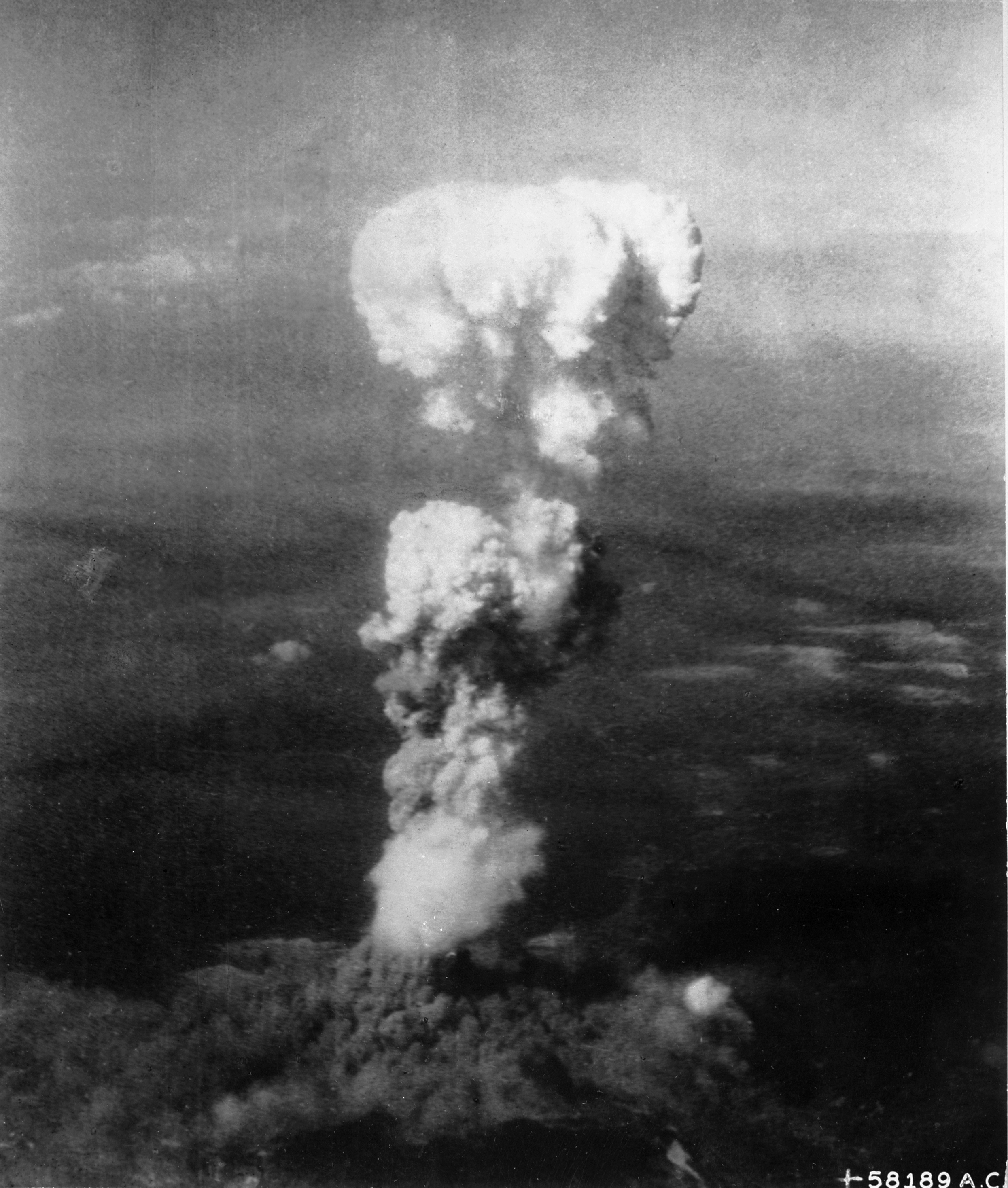
Hiroshima and Nagasaki, two major cities on the Japanese archipelago, sit on the western edge of the Pacific Ocean, facing the East China Sea and the Korean Peninsula across narrow straits — exactly the curved island chain the title clue described. In August 1945, the United…
Read the full account
Hiroshima and Nagasaki, two major cities on the Japanese archipelago, sit on the western edge of the Pacific Ocean, facing the East China Sea and the Korean Peninsula across narrow straits — exactly the curved island chain the title clue described. In August 1945, the United States dropped two atomic bombs on these cities — one on Hiroshima on August 6th and one on Nagasaki on August 9th — killing an estimated 110,000 to 210,000 people and marking the only use of nuclear weapons in warfare in history. Japan is a volcanic archipelago formed where the Pacific Plate subducts beneath the Eurasian and Philippine plates, making it one of Earth's most geologically active regions. This same island-arc position, strung along the western Pacific 'Ring of Fire,' places Japan at the crossroads of Asia's maritime trade routes and within striking distance of the Asian continent's major powers.
1945
Yalta Conference
YALTA · SOVIET UNION

This meeting took place in Yalta, a resort city on the Crimean Peninsula, where the Black Sea's northern shore curves beneath the Crimean Mountains — exactly the southern edge of the vast Eurasian landmass the title clue described. In February 1945, Franklin D. Roosevelt…
Read the full account
This meeting took place in Yalta, a resort city on the Crimean Peninsula, where the Black Sea's northern shore curves beneath the Crimean Mountains — exactly the southern edge of the vast Eurasian landmass the title clue described. In February 1945, Franklin D. Roosevelt, Winston Churchill, and Joseph Stalin met here to plan Europe's postwar shape, agreeing on free elections in Eastern Europe and laying groundwork for the United Nations. The Soviet Union soon broke those democratic promises, installing communist governments across Eastern Europe instead. Crimea itself sits on a peninsula dangling into the Black Sea, connected to the mainland by a narrow neck of land — a strategically prized position that has made it a flashpoint between great powers for centuries, from the Crimean War of the 1850s to conflicts in the modern era.
1945
Liberation of Auschwitz
OŚWIĘCIM (AUSCHWITZ) · POLAND

This was Oświęcim — known to the world by its German name, Auschwitz — in southern Poland, sitting on the flat basin of the upper Vistula River just north of where the Carpathian Mountains rise along Poland's southern edge. On January 27, 1945, Soviet forces broke through the…
Read the full account
This was Oświęcim — known to the world by its German name, Auschwitz — in southern Poland, sitting on the flat basin of the upper Vistula River just north of where the Carpathian Mountains rise along Poland's southern edge. On January 27, 1945, Soviet forces broke through the gates of the Auschwitz-Birkenau complex, the largest Nazi concentration and extermination camp, where over a million people — the vast majority of them Jewish — had been murdered. Poland occupies the broad North European Plain, a flat corridor stretching from France to Russia with no major mountain barriers to stop movement east or west, which is one reason this region has been crossed and contested by armies for centuries. The Vistula, Poland's longest river, runs from those Carpathian foothills all the way north to the Baltic Sea, threading through the heart of the country and past many of its most historically significant sites.
1945
German Surrender — VE Day
REIMS · FRANCE

Rewrote detail to drop ungrounded geography (draft invented Reims/east of Paris/Belgian frontier/agricultural plain — none in extract). New detail 148 words, strictly within grounded_keep.json[34].extract.
Wikipedia ↗